 INSTITUTE FOR NATURAL RESOURCES
Oregon Explorer Top Menu
You are here
Umpqua
Calapooya Creek Watershed
Key Statistics
| Size (acres) | 157,282 |
| Percent public ownership | 8 |
| Miles of anadromous salmonid streams | 171 |
| Highest elevation (feet) | 4,443 |
| Lowest elevation (feet) | 320 |
Location and Size
The Calapooya Creek fifth-field watershed is located in the north-central Umpqua Basin and is 157,282 acres. The watershed stretches a maximum of 13 miles north to south and 27 miles east to west. Calapooya Creek is 36 miles long and is a tributary to the Umpqua. River.

E&S Environmental Chemistry
View large image
|
View as PDF
Landscape and Features
In the western portion of the Calapooya Creek Watershed, the landscape is mostly broad floodplains and terraces with gentle to moderate slopes. Elevation for most of the area ranges from 500 to 1,000 feet. The lowest point in the watershed is 320 feet where Calapooya Creek meets the Umpqua River in the southwest. In the eastern portion of the watershed and along the extreme western border, elevations range from 1,500 to 4,000 feet. Middle Mountain, located on the watershed's eastern border, is the highest point at 4,443 feet.
There are three highways within the Calapooya Creek Watershed: Interstate 5, Highway 99, and Highway 138. All of the City of Oakland and the northwestern portion of the City of Sutherlin are within the watershed. According to census data, the population of the City of Oakland was 954 people in 2000.
The most common land use in the Calapooya Creek Watershed is forestry, with 64% of the land base used for public or private forestry. Agriculture constitutes 33% of the land use and mostly occurs in the western half of the watershed. Land ownership is primarily private (91%), with public ownership mostly administered by the Bureau of Land Management.

E&S Environmental Chemistry
View large image
|
View as PDF
Current Conditions
The Calapooya Creek Watershed provides habitat for winter steelhead, cutthroat trout, coho, and fall chinook. Many introduced fish species such as smallmouth bass have established populations in the Umpqua River. Although warm-water fish have been reported in the Calapooya Creek Watershed, these introduced fish have not been able to establish resident populations within Calapooya Creek or its tributaries.
In the western portion of the watershed and along most of Calapooya Creek, riparian areas are primarily thin strips of hardwoods with brush and blackberries. Conifer forest-dominated riparian areas are more common in the eastern portion of the watershed and along the watershed's extreme western edge. During the summers of 1993 through 1995, the Oregon Department of Fish and Wildlife conducted stream habitat surveys in the Calapooya Creek Watershed. Survey results showed that throughout the watershed, streams had poor levels of large woody debris and poor riffles.
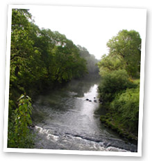
Photo courtesy of Partnership
for the Umpqua Rivers
In the Calapooya Creek Watershed, seven streams are considered water quality limited for habitat or flow modification. These streams are: Bachelor Creek (flow), Calapooya Creek (habitat), Coon Creek (flow), Dodge Canyon Creek (habitat and flow), Oldham Creek (flow), Pollock Creek (flow), and Williams Creek (habitat and flow).Two streams within the Calapooya Creek Watershed are on the Oregon Department of Environmental Quality (ODEQ) 303(d) list for violating water quality standards. Calapooya Creek is listed for temperature, dissolved oxygen, pH, and fecal coliform. Cook Creek, a very small tributary that flows through the northwestern portion of the City of Sutherlin, is listed for copper, lead, iron and manganese.
In 2000, ODEQ concluded that the Bonanza Mine, which was active from the late 1800s until 1960, is a significant source of mercury and arsenic contamination in Foster Creek, Banks Creek, and Calapooya Creek. Concentrations of mercury and arsenic in the soils at the Bonanza Mine site present a health risk to people living on the property.
Tailings from the Bonanza Mine were used to construct a Weyerhaeuser railroad grade; the grade is now Red Rock Road, which is not surfaced. Red Rock Road follows Calapooya Creek throughout most of the eastern half of the watershed. Red Rock Road's mercury and arsenic concentrations exceed safe levels for residential exposure. The road appears to be a potential source of continuous metal contamination to Calapooya Creek.
Specific UBWC Enhancement Opportunities for the Calapooya Creek Watershed
1. Actively seek out opportunities with landowners, businesses, and resident groups in key areas to enlist participation in the following restoration projects and activities:
-
Improve irrigation efficiency and instream water leasing (all streams with water rights, such as Bachelor Creek and Oldham Creek
-
Instream structure placement (esp. Hinkle Creek and streams above Gassy Creek including Calapooya Creek and Riparian planting, blackberry conversion, fencing, and alternative livestock watering systems in the following areas:
-
Calapooya Creek from Dodge Canyon to Oldham Creek.
-
Oldham Creek.
-
Pollock Creek.
-
Cabin Creek.
-
Williams/Norton Creek.
-
Bachelor Creek.
-
2. Work with interested landowners on a case-by-case basis on the following project types:
-
Improve instream fish habitat in areas with good riparian zones and active channels less than 30 feet.
-
Enhance and/or protect riparian zones and wetlands to improve wildlife habitat, fish habitat, and water quality conditions.
3. Develop educational materials and/or outreach programs to educate target audiences about fish habitat and water quality-related issues:
-
Create educational brochures about bank erosion, the problems associated with channel modification, and the importance of riparian areas. These could be given to new landowners through real estate agents.
-
Develop public service announcements about ways of improving or maintaining riparian and instream conditions, such as the benefits of riparian fencing and how to use fertilizers and pesticides in a stream-friendly fashion.
-
Design engaging displays about fish passage barriers for community events, such as the Douglas County Fair.
-
Give presentations at citizen groups about the benefits to landowners and to fish that result from upland stock water systems, off-channel shade trees, and instream water leasing.
4. Support local fish habitat and water quality research:
-
Train volunteers to conduct fish and water quality monitoring and research.
-
Provide equipment necessary for local water quality research and monitoring.
-
Survey long-term landowners and residents about historical and current fish distribution and abundance.
-
Encourage school and student participation in monitoring and research.
5. Enlist landowner participation to remove fish passage barriers as identified.
6. Educate policy makers about the obstacles preventing greater landowner participation in voluntary fish habitat and water quality improvement methods.
Sources
Geyer, Nancy A. Calapooya Creek Watershed Assessment and Action Plan. Roseburg, Oregon: Prepared for the Umpqua Basin Watershed Council; 2003 July.
Umpqua


