 INSTITUTE FOR NATURAL RESOURCES
Soils of the wetlands are literally 'drowned' by ponded or flood waters, or have high water tables, and are subject to loss of oxygen from the atmosphere. The general lack or poor availability of air in these soils drives a different set of biological and chemical processes than are found in other types of soils. There are many species of soil microbes that flourish in such poorly aerated or "anaerobic" conditions. Wetland plants and animals, soil microbes, and the chemistry of the soil waters work together to create unique patterns of iron and other natural elements. These patterns persist even when the soil is dry and thus help scientists to identify wetlands, even during dry spells.

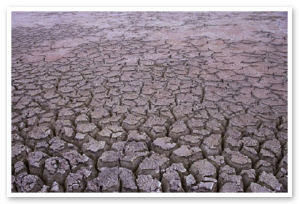
Lake County Playa during dry season
(Bruce Taylor)
For more information on hydric soils, see the NRCS Hydric Soils Website.
A statewide GIS layer of hydric and other wetland soils compiled from NRCS, USFS, and Weyerhaeuser, is available through the Oregon Spatial Data Library. On that page, thumbnail maps indicate the extent of available hydric soil mapping and the sources of the data.

