 INSTITUTE FOR NATURAL RESOURCES
Oregon Explorer Top Menu
You are here
Watersheds
Upper Smith River Watershed
Key Statistics
| Size (acres) | 95,520 |
| Percent public ownership | 58 |
| Miles of anadromous salmonid streams | 191 |
| Highest elevation (feet) | 1,850 |
| Lowest elevation (feet) | 190 |
Location and Size
The Upper Smith River fifth-field watershed is located in the northwestern portion of the Umpqua Basin. The watershed is approximately 95,520 acres, stretching 10 miles north to south and 23 miles east to west. The Upper Smith River flows westward from headwaters in the vicinity of Lookout Mountain to the confluence with the West Fork Smith River.

E&S Environmental Chemistry
View large image
|
View as PDF
Landscape and Features
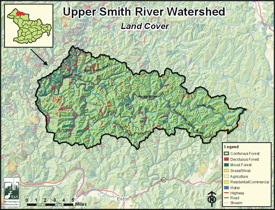
Elevations in the Upper Smith River Watershed range from 190 feet near the confluence with the West Fork Smith River to 1,850 feet at Peterson Point. The watershed is fairly steep with stream channels that dissect the landscape. Major tributary streams include Halfway Creek, North Sister Creek, and the South Fork Smith River.
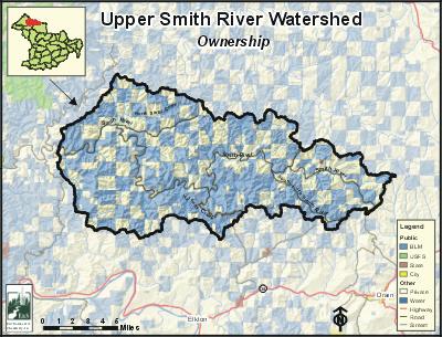
Land use in the Upper Smith River Watershed is almost exclusively forestry, which accounts for over 99% of the watershed. All other land uses constitute less than one percent of the watershed. Fifty-eight percent of the watershed is publicly owned, and is managed by the Bureau of Land Management (BLM). State-managed lands constitute less than one percent of the watershed. Private lands account for 41% of the watershed, most of which is owned by large commercial timber companies.
Very few people reside in the Upper Smith River Watershed, and there are no population centers within the watershed. The primary road in the watershed is Smith River Road, which enters the watershed at the confluence with the West Fork Smith River and follows the river eastward exiting the watershed near the headwaters.
E&S Environmental Chemistry
View large image
|
View as PDF
Current Conditions
The Upper Smith River Watershed is home to many fish species, including coho and chinook salmon, winter steelhead, and cutthroat trout. There are about 191 miles of anadromous salmonid streams within the Upper Smith River Watershed. Nearly all medium and large tributary streams within the watershed are used by coho salmon and winter steelhead for spawning and rearing. Fall chinook salmon spawning and rearing habitat is found in the Upper Smith River to the confluence of Haney Creek, as well as in the lower reaches of North Sister, South Sister, and Big creeks. There are no comprehensive data about resident cutthroat distribution in the Upper Smith River Watershed, but resident cutthroat are generally limited to small tributaries above the ranges of anadromous fish.
According to Oregon Department of Fish and Wildlife data, there are 17 culverts that may be barriers or obstacles to fish passage, of which seven are known to block at least one species of fish. There is also one gradient barrier and one debris jam that may be impeding fish passage. Large woody debris is generally lacking throughout the watershed, but overall fish habitat conditions are better than average in the Upper Smith River Watershed, compared with other coastal Oregon systems.
Several streams in the watershed are included on the Oregon Department of Environmental Quality's (ODEQ) 303(d) list of water quality-limited streams for summer water temperature exceedances. The Upper Smith River is listed upstream to the confluence of Hall Creek. Additionally, the South Fork Smith River, and Cleghorn, Halfway, Russell, Herb, South Sister, and Bum creeks are listed for water temperature. The ODEQ is currently completing a Total Maximum Daily Load (TMDL) analysis for the Umpqua Basin, including the Upper Smith River, which will provide guidance for improving water quality conditions.
Compiled by Jay Walters, private consultant, Barnes and Associates (2006)


