A COLLABORATION OF: OSU LIBRARIES & PRESS  INSTITUTE FOR NATURAL RESOURCES
INSTITUTE FOR NATURAL RESOURCESOregon Explorer Top Menu
You are here
Umpqua
Umpqua

There are three active watershed councils in the Umpqua
Basin: the Elk Creek Watershed Council, the Partnership for the
...

Address: 16513 Elkhead Road, Oakland, OR 97462
Phone: (...
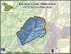
Key Statistics
Size (acres)
19,476
Percent public ownership
100
Miles...

Key Statistics
Size (acres)
103,001
Percent Public Ownership...
Image courtesy of the National Oceanographicand Atmospheric Administration
Stretching from the Cascades to the Pacific Ocean, the 2.7-...

Key Statistics
Size (acres)
102,212
Percent public ownership
94
Miles...

Key Statistics
Size (acres)
67,930
Percent Public...
Monitoring involves a series of observations, measurements, or samples collected and analyzed over time. Many reasons exist for monitoring water...

Key Statistics
Size (acres)
86,966
Percent public ownership
>99
...

Key Statistics
Size (acres)
89,039
Percent Public Ownership...
Pages


