 INSTITUTE FOR NATURAL RESOURCES
Oregon Explorer Top Menu
You are here
North Santiam
North Santiam
LOADING...

Please be patient.
-
Geology and geochemistry of hydrothermal alteration, eastern portion of the North Santiam mining area
The Ruth Mine is a base-metal vein deposit near the eastern margin of a reported porphyry copper deposit in the Western Cascade Range in Oregon. Uplift of the Western Cascade Range has resulted in a deeply...
-
Shooting rapids
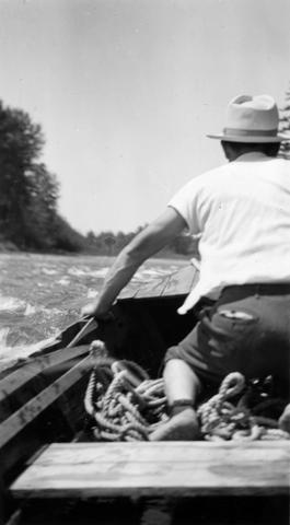
Shooting the rapids on the North Santiam River during the North Santiam survey ; 1940-08-06
-
Bridge spanning North Santiam River in Stayton, OR

Bridge spanning North Santiam River at Stayton, Oregon. Built in 1912, razed in 1965.
-
Micarea peliocarpa
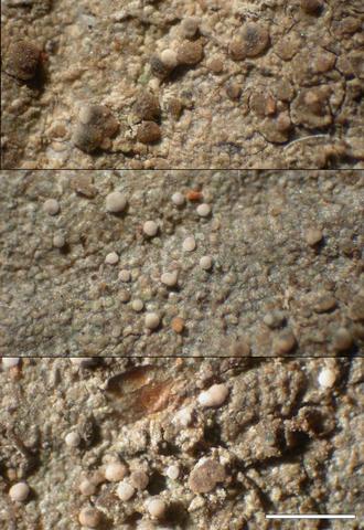
Habit; Habitat: Populus trichocarpa - Alnus rubra - Acer macrophyllum; Location: North Santiam ACEC, floodplain of North Santiam River; Substrate: Bark, Alnus rubra; Elevation: 159 meters.
-
Micarea peliocarpa
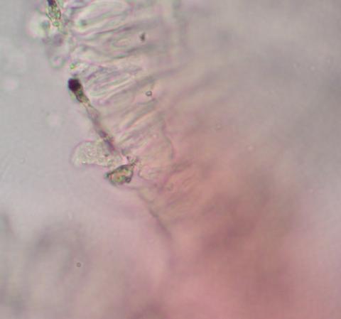
Epithecium C reaction; Habitat: Populus trichocarpa - Alnus rubra - Acer macrophyllum; Location: North Santiam ACEC, floodplain of North Santiam River; Substrate: Bark, Alnus rubra; Elevation: 159 meters.
-
Micarea peliocarpa
Exciple; Habitat: Populus trichocarpa - Alnus rubra - Acer macrophyllum; Location: North Santiam ACEC, floodplain of North Santiam River; Substrate: Bark, Alnus rubra; Elevation: 159 meters.
-
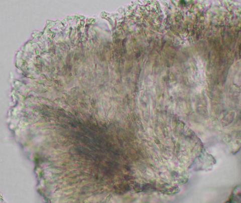
Micarea peliocarpa
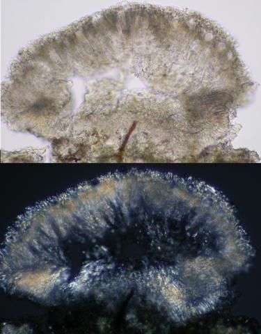
Apothecial section; Habitat: Populus trichocarpa - Alnus rubra - Acer macrophyllum; Location: North Santiam ACEC, floodplain of North Santiam River; Substrate: Bark, Alnus rubra; Elevation: 159 meters.
-
Case study: North Santiam School District : homework pays off for North Santiam schools

This archived document is maintained by the Oregon State Library as part of the Oregon Documents Depository Program. It is for informational purposes and may not be suitable for legal purposes.
-
Prehistoric land-use patterns in the North Santiam subbasin on the western slopes of the Oregon Cascade Range
This thesis examines prehistoric land use patterns of the entire North Santiam
-
Using Turbidity Monitoring and LiDAR-Derived Imagery to Investigate Sources of Suspended Sediment in the Little North Santiam...
The Little North Santiam River Basin is a 111-square mile watershed located in the Cascade Range of western Oregon. The Little North Santiam River is a major tributary to the North Santiam River, which is the...
Pages


