 INSTITUTE FOR NATURAL RESOURCES
Oregon Explorer Top Menu
You are here
Roseburg North
Roseburg North
LOADING...

Please be patient.
-
The geology of the Floras Creek area, Curry County, Oregon
The Floras Creek area, east of the town of Langlois, near the southwest Oregon coast, includes Colebrooke Schist (a klippe of metamorphosed pelitic sediments of Jurassic age), Jurassic Otter Point Formation (a...
-
Geochemical evolution of the Roseburg formation basaltic rocks, southern Oregon coast range
The Paleocene-lower Eocene volcanic rocks of the southern Oregon Coast Range
-
Millpond maintenance facility decision document
11 pp. Section 21; T25S, R02W. Captured March 7, 2008.
-
Umpqua Basin tree revetment project 2006 environmental assessment
22 pp. Tables, references, maps. Deer Creek (both forks) 27 South
-
Sampo; Re-generat-or (the Sampo)

"Sampo" is a mysterious object often referred to in the mythological songs of the Finnish. According to the artist, the sampo is forged by the creator-smith Ilmarinen for Louhi, the hag-goddess of the...
-
North Umpqua Wild and Scenic River environmental assessment
148 pp. Figures, tables, appendices, references. The 33.8-mile segment of the North Umpqua Wild and Scenic River from Soda Springs powerhouse downstream to Rock Creek is located exclusively within Douglas...
-
The structure, geologic evolution and regional significance of the Bethel Creek-North Fork area, Coos and Curry counties,...
The original purpose of this study was a detailed structural analysis of the Jurassic Otter Point Formation in order to determine if the Canyonville Fault Zone, which forms the northern boundary of the Klamath...
-
General Joseph Lane, first territorial governor
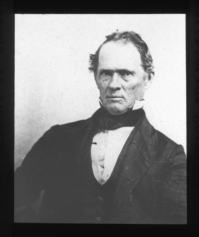
General Joseph Lane, was born in North Carolina, reared in Kentucky, and moved to Indiana when a young man. He served with distinction in the Medican War and, when Oregon became a Territory, was appointed by...
-
Structural Geology of the Northeast Quarter of the Dutchman Butte Quadrangle, Southwest Oregon
The northeast quarter of the Dutchman Butte quadrangle straddles the boundary of the Mesozoic Klamath Mountains province and the Tertiary Coast Range province. The boundary in this area is controlled by a major...
-
Relations between geology and mass movement features in a part of the East Fork Coquille River watershed, southern Coast...
Various types of mass movement features are found in the drainage
Pages


