 INSTITUTE FOR NATURAL RESOURCES
Oregon Explorer Top Menu
You are here
Columbia County
Columbia County
LOADING...

Please be patient.
-
PH037_05967
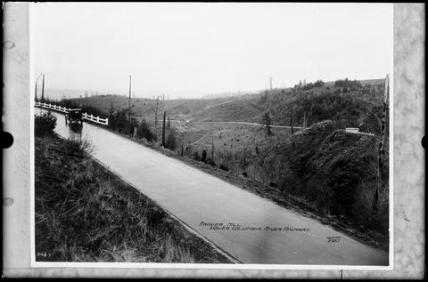
Ranier Hill. Lower Columbia River Highway.
-
PH037_05965
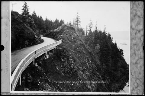
Prescott Point, Lower Columbia River Highway.
-
PH037_01977
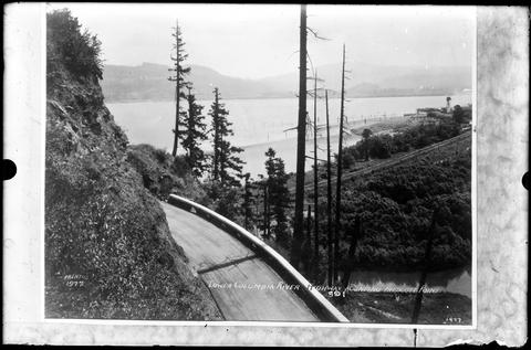
Lower Columbia River Highway. Rounding Prescott Point. Looking north.
-
Hood River, Oregon, from across the Columbia, Mt. Hood in the distance.
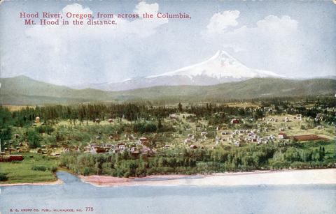
A colored postcard. The legend in red at top left reads "Hood River, Oregon, from across the Columbia, Mt. Hood in the distance." In the foreground is the Columbia River. On the far shore is a wooded bank, and...
-
Hood River, Oregon, from across the Columbia, Mt. Hood in the distance.

A colored postcard. The legend in red at top left reads "Hood River, Oregon, from across the Columbia, Mt. Hood in the distance." In the foreground is the Columbia River. On the far shore is a wooded bank, and...
-
Cascade Rapids before the Bonneville Dam was built
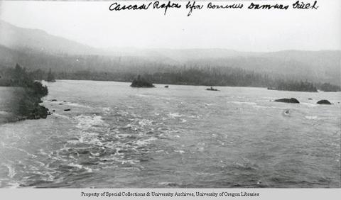
A black and white view that has been identified as Cascade Rapids on the Columbia River, seen before the Bonneville Dam was built. In the foreground are low white-capped waves; to the right a low, tree-lined...
-
Cascade Rapids before the Bonneville Dam was built

A black and white view that has been identified as Cascade Rapids on the Columbia River, seen before the Bonneville Dam was built. In the foreground are low white-capped waves; to the right a low, tree-lined...
-
Bridge of the Gods, Columbia River, On line of O. R. & N. Co.

A colored postcard view of the Columbia River. In the top right-hand corner in red the text reads "Bridge of the Gods, Columbia River. On line of O. R. & N. Co." In the foreground of the picture is a rocky...
-
Bridge of the Gods, Columbia River, On line of O. R. & N. Co.

A colored postcard view of the Columbia River. In the top right-hand corner in red the text reads "Bridge of the Gods, Columbia River. On line of O. R. & N. Co." In the foreground of the picture is a rocky...
-
Tall bridge across Columbia River at Hood River. Mt. Hood, Hood River, and Hood River Valley on far side of river
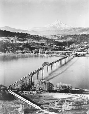
A black and white view of the toll bridge built across the Columbia River to link Hood River, Oregon, with the vicinity of Bingen, Washington. Built in the 1920s. This view is looking south towards Hood River...
Pages


