 INSTITUTE FOR NATURAL RESOURCES
Oregon Explorer Top Menu
You are here
Middle Willamette
Middle Willamette
LOADING...

Please be patient.
-
213-O48 Office covered bridge (Westfir, North Fork of Middle Fork Willamette River)

Office bridge in Westfir, Oregon, over the North Fork of Middle Fork Willamette River is a 180 foot Howe covered bridge built in 1944. Location: T21S R3E S18
-
Influences of landslides, floods and land use on channel changes of the upper Middle Fork Willamette River, Oregon 1936-1980
Time trends in flow and channel characteristics were evaluated for the Middle Fork Willamette (MFW) River, which drains a 668 km2 forested watershed in the Cascade Mountains of western Oregon. Timber
-
Fish and wildlife resources of the Middle Willamette Basin, Oregon, and their water use requirements: a report to the State...

This archived document is maintained by the Oregon State Library as part of the Oregon Documents Depository Program. It is for informational purposes and may not be suitable for legal purposes.
-
Bull trout Salvelinus confluentus population and habitat surveys in the McKenzie and Middle Fork Willamette Basins, 1999

This archived document is maintained by the Oregon State Library as part of the Oregon Documents Depository Program. It is for informational purposes and may not be suitable for legal purposes.
-
The fish and wildlife resources of the Lower Willamette Basin, Oregon, and their water use requirements.
Federal Aid to Fish Restoration Progress Report
-
Middle Willamette River fish consumption study

This archived document is maintained by the Oregon State Library as part of the Oregon Documents Depository Program. It is for informational purposes and may not be suitable for legal purposes.
-
Profile surveys in 1914 on Middle fork of Willamette River and White River, Oregon
Gerald W. Williams Collection
-
Records of wells, water levels, and chemical quality of water in the Lower Santiam River Basin, Middle Willamette Valley,...

This archived document is maintained by the Oregon State Library as part of the Oregon Documents Depository Program. It is for informational purposes and may not be suitable for legal purposes.
-
Jap Hills sawing wood
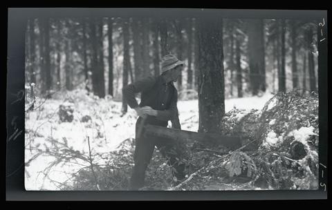
Jap Hills using a hand saw to cut a log in the middle of a snow covered field. On a hunting trip near the Upper Willamette River.
-
Log drive on the North Fork Willamette River
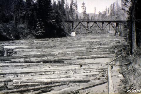
Picture is numbered 191314.
Pages


