 INSTITUTE FOR NATURAL RESOURCES
Oregon Explorer Top Menu
You are here
Upper North Santiam River
Upper North Santiam River
LOADING...

Please be patient.
-
Preliminary report on the reconnaissance geology of the upper Clackamas and North Santiam Rivers area, Cascade Range, Oregon

This archived document is maintained by the Oregon State Library as part of the Oregon Documents Depository Program. It is for informational purposes and may not be suitable for legal purposes.
-
Using Turbidity Monitoring and LiDAR-Derived Imagery to Investigate Sources of Suspended Sediment in the Little North Santiam...
The Little North Santiam River Basin is a 111-square mile watershed located in the Cascade Range of western Oregon. The Little North Santiam River is a major tributary to the North Santiam River, which is the...
-
Monthly Report February 1948
Abstract -- None
-
Willamette Biological Opinion Hatchery Research 2002-2005 Final Report
Abstract -- RECOMMENDATIONS
-
Appraisal of recreation potentials in the Lower Little North Santiam Basin
-
Upper dam above Stayton

Upper dam above Stayton, Oregon, on the North Santiam River;1940-08-08
-
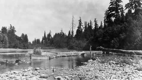
Upper dam above Stayton
Upper dam above Stayton, Oregon, on the North Santiam River;1940-08-08
-
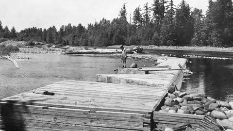
Upper dam above Stayton
Upper dam above Stayton, Oregon, on the North Santiam River;1940-08-08
-
Willamette BiOp - Genetic Stock Identification and Relative Natural Production of Willamette River Steelhead
Abstract -- We used genotypic data from 15 microsatellite loci to characterize the stock structure of Oncorhynchus mykiss in the upper Willamette River basin. We then used two analytical approaches, implemented...
-
South Santiam Watershed Assessment
Abstract -- The South Santiam River drains approximately 1,040 square miles and is a primary tributary
Pages


