A COLLABORATION OF: OSU LIBRARIES & PRESS  INSTITUTE FOR NATURAL RESOURCES
INSTITUTE FOR NATURAL RESOURCESOregon Explorer Top Menu
You are here
Geology
Geology
Geology
Landscapes and Ecosystems
LOADING...

Please be patient.
Search
Searched for:
Geology
-
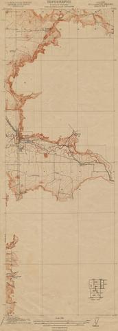
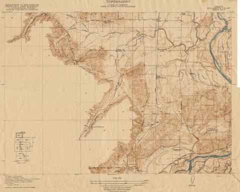
Oregon Willamette Valley, sheet no. 5; Historic topo[topographic] map of the Willamette Valley
Surveyed in 1911. Contour interval 5 feet. Scale 1/31680
-
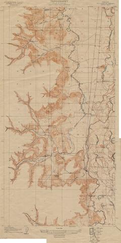
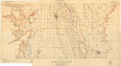
Oregon Willamette Valley, sheet no. 4; Historic topo[topographic] map of the Willamette Valley
Surveyed in 1910. Contour interval 5 feet. Scale 1/31680
-
Oregon Willamette Valley, sheet no. 7; Historic topo[topographic] map of the Willamette Valley
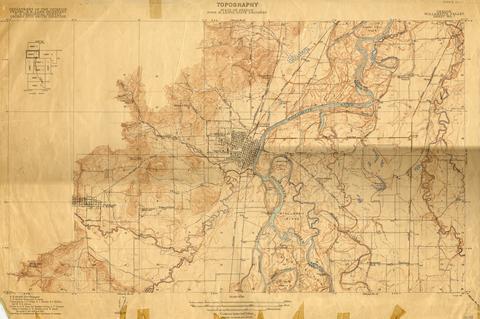
Surveyed in 1911-1912 and 1913. Contour interval 5 feet. Scale 1/31680
-
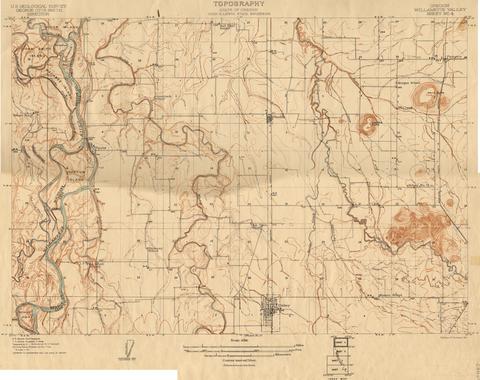
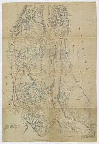
Oregon Willamette Valley, sheet no. 6; Historic topo[topographic] map of the Willamette Valley
Surveyed in 1909-1911. Contour interval 5 feet. Scale 1/31680
-
Oregon Willamette Valley, sheet no. 8; Historic topo[topographic] map of the Willamette Valley
Surveyed in 1911 and 1914.
-
Oregon Willamette Valley, sheet no. 3; Historic topo[topographic] map of the Willamette Valley
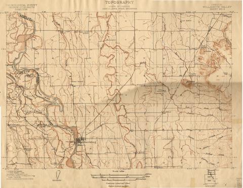
Surveyed in 1908 and 1909. Contour interval 5 feet. Scale 1/31680
-
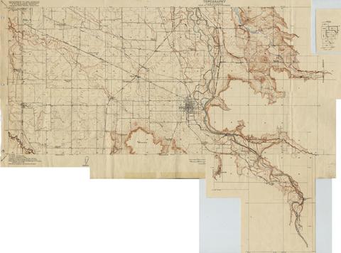
Oregon Willamette Valley, sheet no. 2; Historic topo[topographic] map of the Willamette Valley
Surveyed in 1908 and 1909. Contour interval 5 feet and 10 feet changing on the 450 foot contour. Scale 1/31680
-
Oregon Willamette Valley, sheet no. 9; Historic topo[topographic] map of the Willamette Valley
Surveyed in 1913 and 1914. Contour interval 5 feet and 25 feet, changing on the 450 foot contour. Scale 1/31680
-
Map of Columbia River and Sauvie Island, 1934
Map shows plans for proposed pumping plant, drainage canals and levees for flood control.


