 INSTITUTE FOR NATURAL RESOURCES
Oregon Explorer Top Menu
You are here
Geology
Geology
Landscapes and Ecosystems
LOADING...

Please be patient.
-
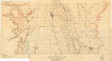
Oregon Willamette Valley, sheet no. 3; Historic topo[topographic] map of the Willamette Valley
Surveyed in 1908 and 1909. Contour interval 5 feet. Scale 1/31680
-
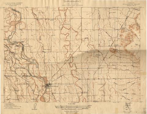
Oregon Willamette Valley, sheet no. 2; Historic topo[topographic] map of the Willamette Valley
Surveyed in 1908 and 1909. Contour interval 5 feet and 10 feet changing on the 450 foot contour. Scale 1/31680
-
Oregon Willamette Valley, sheet no. 9; Historic topo[topographic] map of the Willamette Valley
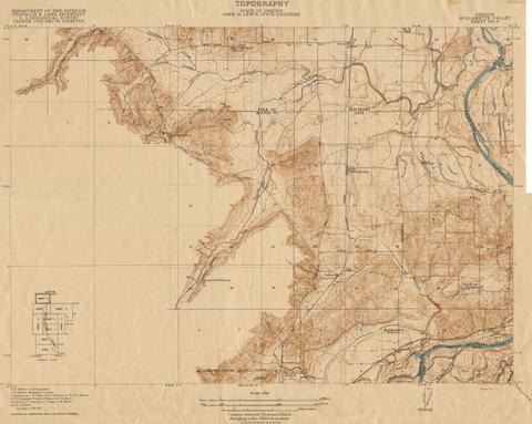
Surveyed in 1913 and 1914. Contour interval 5 feet and 25 feet, changing on the 450 foot contour. Scale 1/31680
-
Map of Columbia River and Sauvie Island, 1934
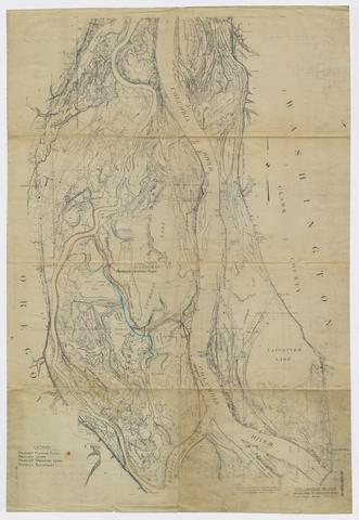
Map shows plans for proposed pumping plant, drainage canals and levees for flood control.
-
Comparison of habitats near spur dikes, continuous revetments, and natural banks for larval, juvenile, and adult fishes of...
The research on which this report is based was financed in part by the United States Department of the Interior as authorized by the Water Research and Development Act of 1978 (P.L. 95-467).
-
Review of The quality of our nation's waters : nutrients and pesticides
2 p. Review produced for HC 441: Science Colloquium: Willamette River Environmental Health, Robert D. Clark Honors College, University of Oregon , Spring term, 2004.
-
Review of Estimates of ground-water recharge, base flow, and stream reach gains and losses in the Willamette River Basin,...
1 p. Review produced for HC 441: Science Colloquium: Willamette River Environmental Health, Robert D. Clark Honors College, University of Oregon, Spring term, 2004.
-
Summary of information on aquatic biota and their habitats in the Willamette Basin, Oregon, through 1995
This report reviews and summarizes available information on aquatic biological communities in the Willamette Basin through 1995. Specifically, the report describes (1) the distribution, abndance, and trends of...
-
Forest conditions in the Cascade Range Forest Reserve, Oregon
Subject series H. Forestry 6
Pages


