 INSTITUTE FOR NATURAL RESOURCES
Oregon Explorer Top Menu
You are here
Hazards
Hazards
LOADING...

Please be patient.
-
Flooded area of Portland with Mt. St. Helens? in the background
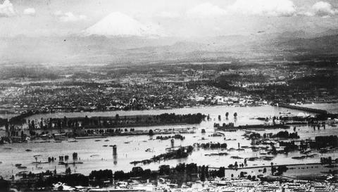
Vanport City was located between the Portland city boundary and the Columbia River. Vanport was destroyed on May 30, 1948 when a section of the dike collapsed during a flood on the Columbia River.
-
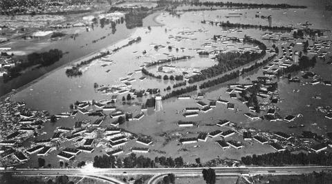
Aerial view of flood at Vanport showing highway
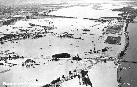
Vanport City was located between the Portland city boundary and the Columbia River. Vanport was destroyed on May 30, 1948 when a section of the dike collapsed during a flood on the Columbia River.
-
Aerial view of flood at Vanport, showing railroad bridge
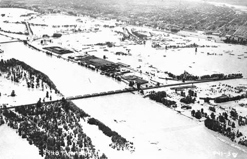
Vanport City was located between the Portland city boundary and the Columbia River. Vanport was destroyed on May 30, 1948 when a section of the dike collapsed during a flood on the Columbia River.
-
OSU Wave Research Facility
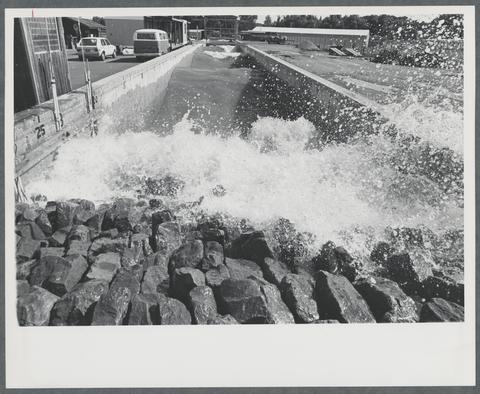
This wave tank, constructed in 1972, was 342 feet long, and served as the genesis for the O.H. Hinsdale Wave Research Laboratory. Research being conducted at the time this photo was taken pertained to oil...
-
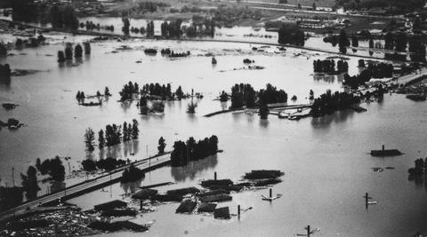
Aerial view of flood at Vanport
Vanport City was located between the Portland city boundary and the Columbia River. Vanport was destroyed on May 30, 1948 when a section of the dike collapsed during a flood on the Columbia River.
-
View of flooded portion of Vanport
Vanport City was located between the Portland city boundary and the Columbia River. Vanport was destroyed on May 30, 1948 when a section of the dike collapsed during a flood on the Columbia River.
-
The bible made free

Events now moved quickly. The fundamental principle of Protestantism--the free circulation of the Scriptures among the people--could no longer be resisted. The Convocation of 1536, on the motion of Cranmer,...
-
Prairie schooner crossing the mountains
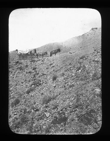
Here is a 'prairie schooner' in the eighteen thirties, crossing the mountains. It was Captain Bonneville who first brought wagons to and over the top of the Rockies. He abandoned them soon afterwards but he had...
-
Design analysis package 274-06: rehabilitate rim village structures
ill., maps, plans; Cover title
-
Crater Lake National Park resources management plan
ill., map; Map included: "The Region, Crater Lake National Park, Oregon [by the] United States Department of the Interior, National Park Service." from another unknown publication; page size 27 x 20 cm.; Also...
Pages


